“It was at the outskirts of Gnadenfeld that as a three-year-old, I experienced the green chill of a near-tornado turned electrical storm. Ever since that day, the creek running diagonally through this property became the boundary to an eerie, sinister domain…”
Thus begins Ernest Braun’s article in Preservings issue 14 entitled Gnadenfeld – The Esau Matriarchy.
Since obtaining the Historical Atlas of the East Reserve (which Ernest Braun co-authored with Glen Klassen), I’ve become a little obsessed with discovering evidence of these ghost villages. There’s very little remaining, aside from cemeteries, the occasional lone headstone, and the odd way some roadways have developed. Therefore, hunting for these abandoned villages in the East Reserve requires a vivid imagination… which I have! Coupled with a great deal of enthusiasm. And… this is how Andrew and I came to be somewhat lost and stuck once again yesterday evening, seeking the fabled village of Gnadenfeld.


I was fully aware that I was making it sound more and more grand every time I told Andrew about the one time I’d been to Gnadenfeld 25 years ago and “the road had a weird jig to it!” (Yes. This is what passes for excitement in my life. NO REGRETS! WOOOOO!) The time had come to revisit this location.
In addition to the Atlas, I also had a detailed Manitoba Back Roads map. I referred to this and noticed that at some point the road we were following just kind of stopped. I assumed this would be Gnadenfeld! We drove up to where the map suggested the road ended… but I suddenly figured the road probably kept going. I cheerfully urged Andrew on. At some point he stopped listening to me, and turned the car around. (I was kind of relieved because it was really beginning to look like I had no idea what I was talking about.) Now that we’re at home, and I checked it out on Google Maps, I can see that we overshot Gnadenfeld, not fully realizing we’d actually arrived. (The “road” we had been following truly led nowhere.) Clearly, I should’ve referred to Google Maps prior to our journey. Perhaps I will do so next time, though I do love the impulsive nature of our little evening car trips.
In comparing the trails map in the Atlas to Google’s satellite view, I believe I can actually still see remnants of the trail that had connected Gnadenfeld to Grunthal. It was likely a much-used trail, which I suppose evolved into a handy approach for tractors and such onto the cultivated field over the years.
I also read these words in the Atlas: “The last house-barn was demolished in about 2000.”
Nooooooooooooooooooo!
This is what’s left:

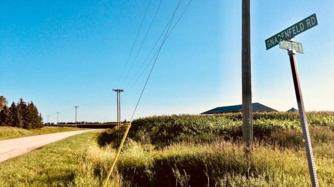
(Feature photo: The “odd jig” at Gnadenfeld Road. Over 100 years ago, the Gnadenfeld Mennonite private school had stood at this corner. And yes, I did edit the heck out of this pic in a completely garish way! I have fun.)

